
Stellafane Photomap
The Aerial Photograph below has been annotated with items of interest for Stellafane. In particular, the approximate boundaries of the three parcels of land that Stellafane now owns are shown, along with major buildings and observatories, and on Stellafane East, a few key locations.
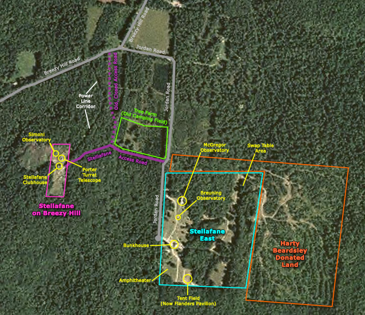
As this map is referenced from our history pages, a couple of historical items of interest are shown: The tree farm, which was a hayfield where all the Convention camping was done prior to the purchase of Stellafane East; and the route of the original access road to Stellafane from Breezy Hill Road. When we purchased Stellafane East we swapped some right-of-ways so the access road to Stellafane now goes to Jordan Road, conveniently near the northeast corner of the Stellafane East parcel.
This photo was take sometime after the summer of 2003 (as the Miller's land west of Stellafane on Breezy Hill has been cleared) and before late summer 2005 (as no evidence of Flanders Pavilion site preparation is visible).
Ground level photographs of most of the buildings identified on this map are availed on our Buildings page.